New GIS Tools Make Site Selection Easy in Emporia, KS
February 13, 2024

Emporia is home to 300 acres of shovel-ready sites located at the connection of I-35 and I-335. Not only does Emporia sit between three major cities – Topeka, Wichita, and Kansas City – but it also serves as a valuable stop between Dallas and Minneapolis.
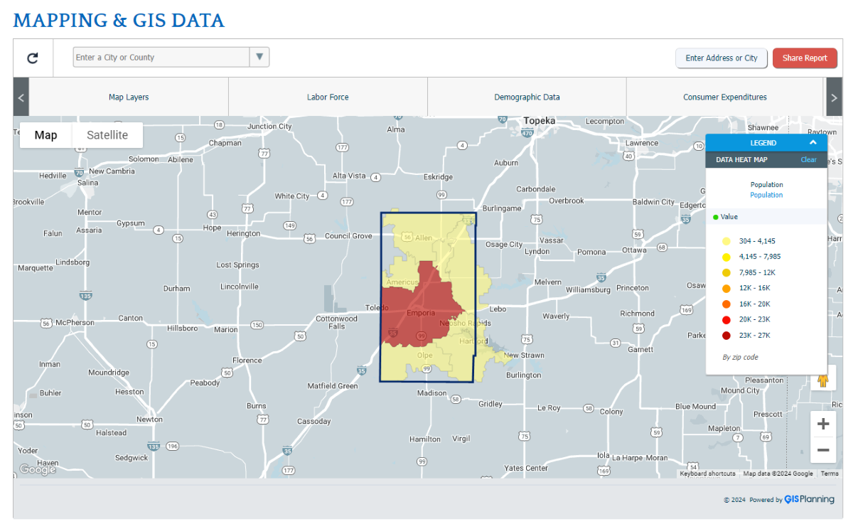
Our team at the Regional Development Association of East Central Kansas (RDA) recently launched a series of GIS tools to help you choose the best pad-ready land for your needs. You can also learn about the community members that make up Emporia and how they can support your workforce needs.
Meet us in the middle and consider bringing your business to Emporia. It’s hard to find a more central location that’s easy to access in the United States.
Explore Available Sites in Emporia
The first place to look when exploring Emporia is our Available Sites page. You can look for existing buildings, pad-ready sites, or shovel-ready land. Not only does this page make it easy to explore the available locations in Emporia, but it also allows you to filter the results based on your needs. Choose specialty features or zoning descriptions to make sure the sites you look at are relevant and useful.
“These tools streamline the site selection process in Emporia,” says Jim Witt, Interim President at the RDA. “We already know that this region is a great place for businesses. Our main focus is finding the best location for every company that wants to expand here.”
You can also use the dedicated Mapping and GIS Data page to explore this region in-depth and visually filter through different demographics.
Get to Know the City of Emporia Demographics
Emporia is a young city. The median age is 29 in an area with nearly 24,000 people. This means there is a young, vibrant workforce that you can pull from. To learn more about the local residents, check out the demographic profile pages for the City of Emporia or Lyon County as a whole.
Learn about the labor force in the area, the average education levels of residents, and the median household income. This tool by GISPlanning allows you to see the most relevant information based on your site selection goals.
Review Our Occupation Data
Another tool by GISPlanning that we have implemented is a chart for occupation data. You can learn about the occupations and key industries for both Emporia and Lyon County.
Sort by the number of jobs to understand the main economic drivers of the area. Using NAICS classifications, you can see that manufacturing is the biggest source of employment in the area and is responsible for 3,658 jobs. Outside of production, the local workforce has experience with transportation, administrative support, and sales-related positions.
This tool is essential if you need to tap into an existing workforce. You can see that the residents of Lyon County are highly skilled and able to jump into new positions when they open up.
Local Businesses Can Benefit From These Tools as Well
The GIS tools launched by the RDA can benefit more than just site selectors and new businesses. Existing companies can make plans to expand using this data. Some of the major employers in Emporia expanded in 2023 and we expect even more growth in the coming years.
“In 2023, brands like Michelin and Simmons Pet Food expanded their presence in Emporia because this area has been good to them,” says Kala Maxfield, chair of the RDA. “Our new GISPlanning tools can help regional businesses grow even more in 2024.”
The RDA also publishes information on infrastructure, tax incentives, and business development so you will have all the resources you need.
Choose Emporia to Grow
Our GIS tools have everything you need to learn about Emporia and its surrounding areas. Plan your site tours and get to know the people who are eager to work in this area. Several existing businesses are already expanding in Emporia. See what attracts them to this community.
Read the success stories of the companies that expanded here and why they chose Emporia.
##
